File:Ember Bay routes.jpg
From Guild Wars 2 Wiki
Jump to navigationJump to search

Size of this preview: 800 × 589 pixels. Other resolutions: 320 × 235 pixels | 640 × 471 pixels | 1,024 × 754 pixels | 1,280 × 942 pixels | 2,560 × 1,884 pixels | 3,862 × 2,842 pixels.
Original file (3,862 × 2,842 pixels, file size: 1.55 MB, MIME type: image/jpeg)
Summary[edit]
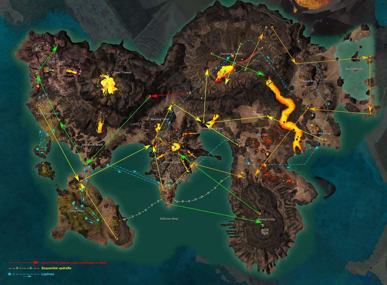
Map of Ember Bay showing Lava Tube, Ley Line & Sequential Updraft Routes. I have it stored in layers on my system so I can edit it. Post a message on my talk page if you have any changes. -- Separ
Summary[edit]
| This screenshot contains property of ArenaNet or NCSoft which is used with permission. The terms of the permission do not include third party use. It is not released under the GFDL. Please see Guild Wars 2 Wiki:Copyrights for further information. |
File history
Click on a date/time to view the file as it appeared at that time.
| Date/Time | Thumbnail | Dimensions | User | Comment | |
|---|---|---|---|---|---|
| current | 03:09, 12 July 2021 | | 3,862 × 2,842 (1.55 MB) | Separ (talk | contribs) | Added Thermal Tube route from Infernal Cape to Observation Outpost |
| 21:39, 8 November 2020 | 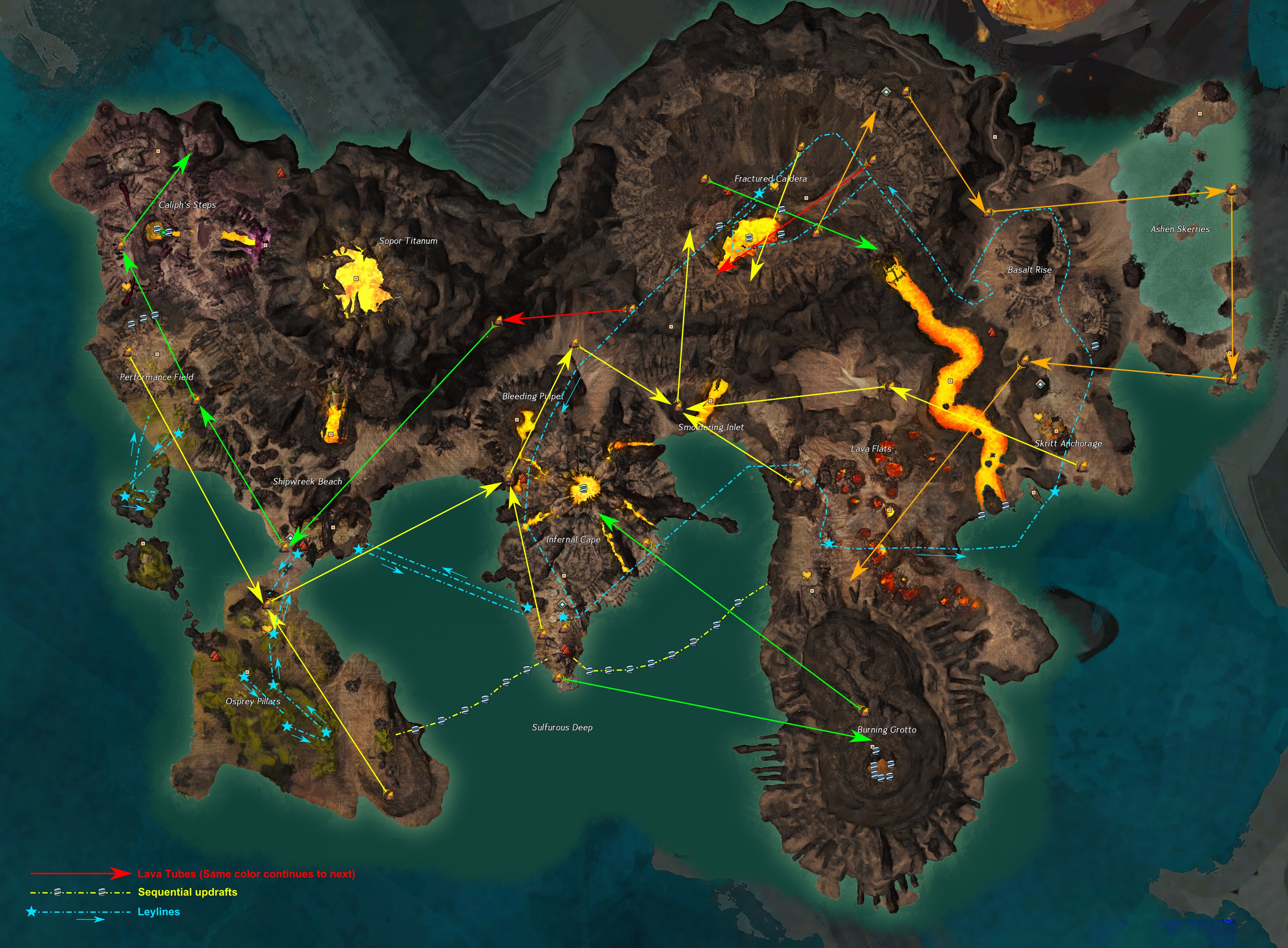 | 3,862 × 2,842 (3.85 MB) | Kvothe (talk | contribs) | Reverted to version as of 18:10, 8 November 2020 (UTC) | |
| 20:09, 8 November 2020 | 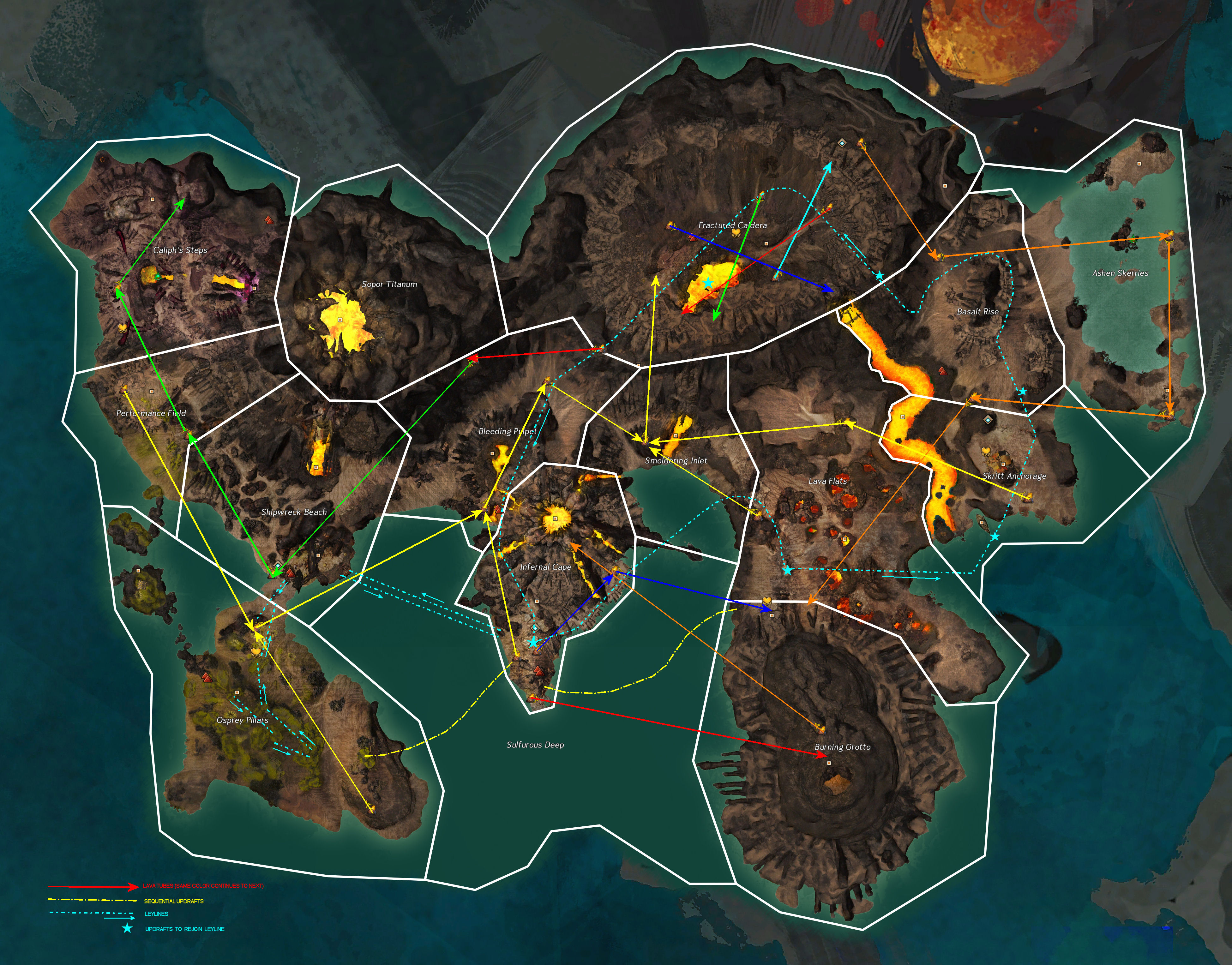 | 3,901 × 3,056 (1.92 MB) | Separ (talk | contribs) | Routes in Ember Bay provided by Leylines, Sequential Updrafts and Lava Tubes | |
| 18:10, 8 November 2020 |  | 3,862 × 2,842 (3.85 MB) | Chieftain Alex (talk | contribs) | and now my version.. added missing leylines on the left, added markers to each updraft, verified locations on everything else. | |
| 18:08, 8 November 2020 | 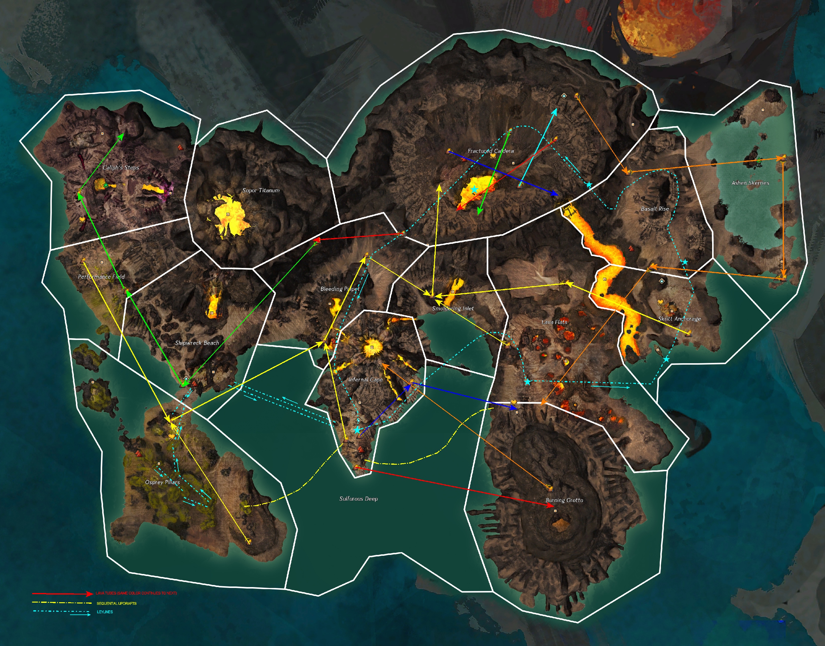 | 2,770 × 2,170 (2.65 MB) | Chieftain Alex (talk | contribs) | {{ArenaNet image|screenshot|Map images}} == Attribution == "File:Ember Bay Routes.png" by Special:Contributions/Separ converted to jpg. |
You cannot overwrite this file.
File usage
The following 2 pages use this file: