File:Storm Top map.jpg
From Guild Wars 2 Wiki
Jump to navigationJump to search

Size of this preview: 533 × 600 pixels. Other resolutions: 213 × 240 pixels | 427 × 480 pixels | 683 × 768 pixels | 910 × 1,024 pixels | 1,600 × 1,800 pixels.
Original file (1,600 × 1,800 pixels, file size: 557 KB, MIME type: image/jpeg)
Summary[edit]
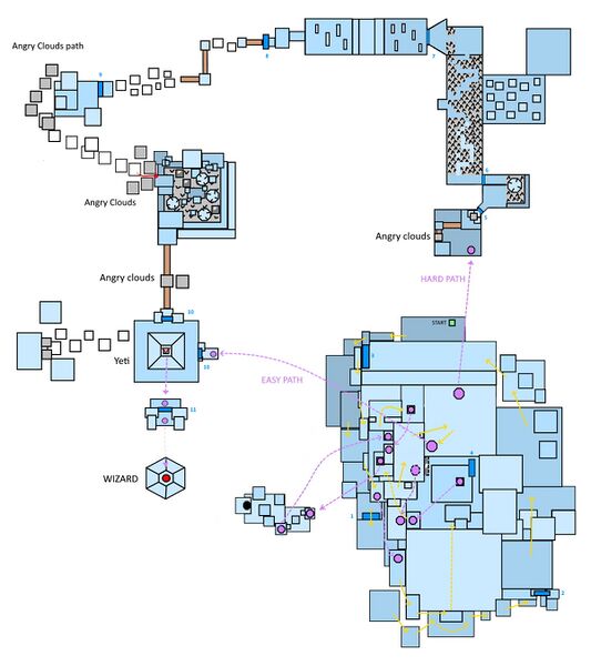
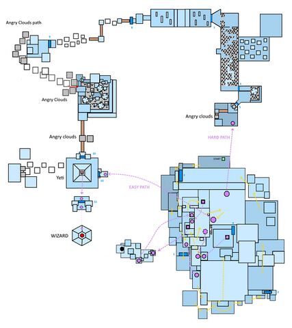
The most difficult map to do, Storm top. I tried to do my best many areas are very hard to cartography because in icy caves. Only the visible parts are shown here, so you don't see within the stone heads, have to base yourself on screenshots. Through added teleporters, checkpoints, and arrows showing the followed path. The blue taints vary on the drawing to explain the altitude. A darker blue is the ground level, light blue the higher level.
Licensing[edit]
| Permission is granted to copy, distribute and/or modify this document under the terms of the GNU Free Documentation License, Version 1.3 or any later version published by the Free Software Foundation; with no Invariant Sections, no Front-Cover Texts, and no Back-Cover Texts. |
File history
Click on a date/time to view the file as it appeared at that time.
| Date/Time | Thumbnail | Dimensions | User | Comment | |
|---|---|---|---|---|---|
| current | 06:55, 11 April 2023 | | 1,600 × 1,800 (557 KB) | Tanetris (talk | contribs) | Redid the northeast section a bit, between checkpoints 5 and 7 |
| 21:22, 7 April 2023 | 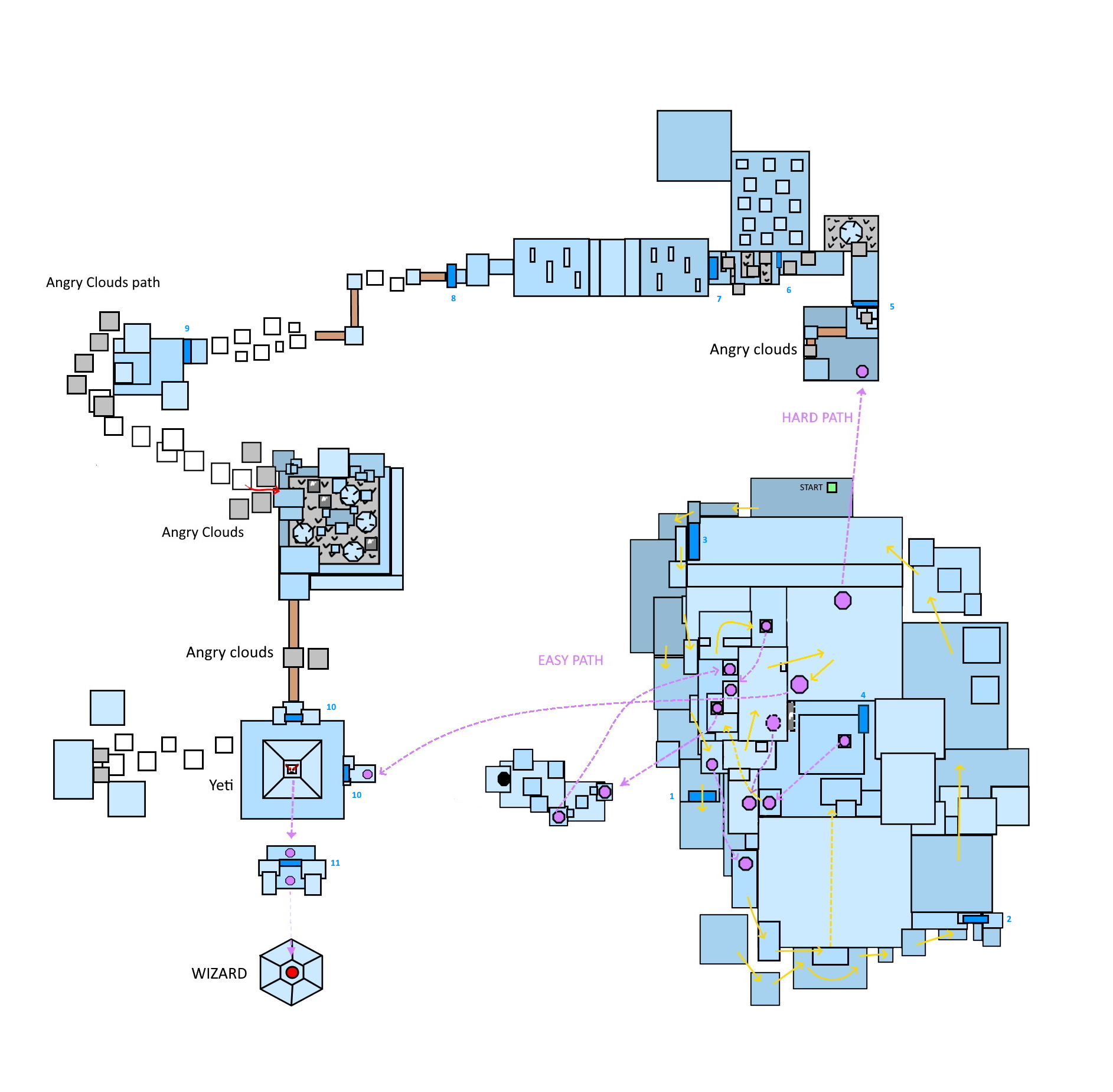 | 1,885 × 1,849 (785 KB) | Chieftain Alex (talk | contribs) | rotated to match ingame compass (flipped all text), added numbers to checkpoints | |
| 14:25, 22 April 2020 | 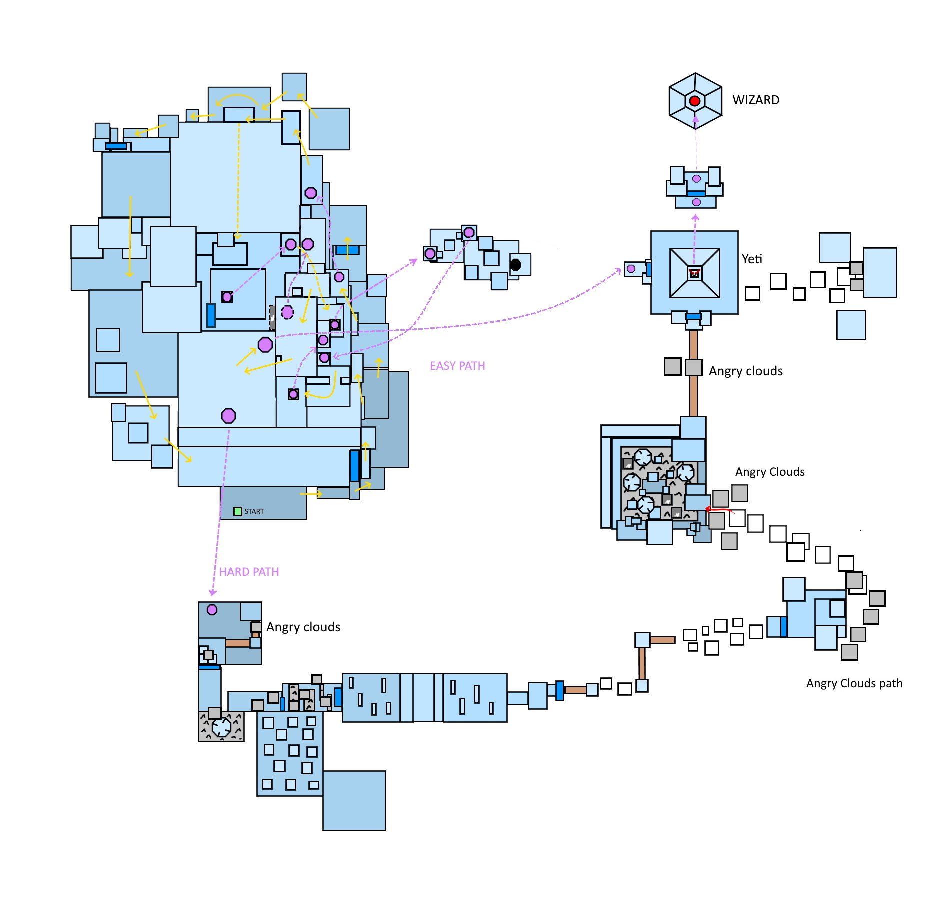 | 1,885 × 1,849 (363 KB) | Inquest Overseer Ezrielia (talk | contribs) | Added block tribulations cloud paths and locations | |
| 11:46, 4 April 2020 | 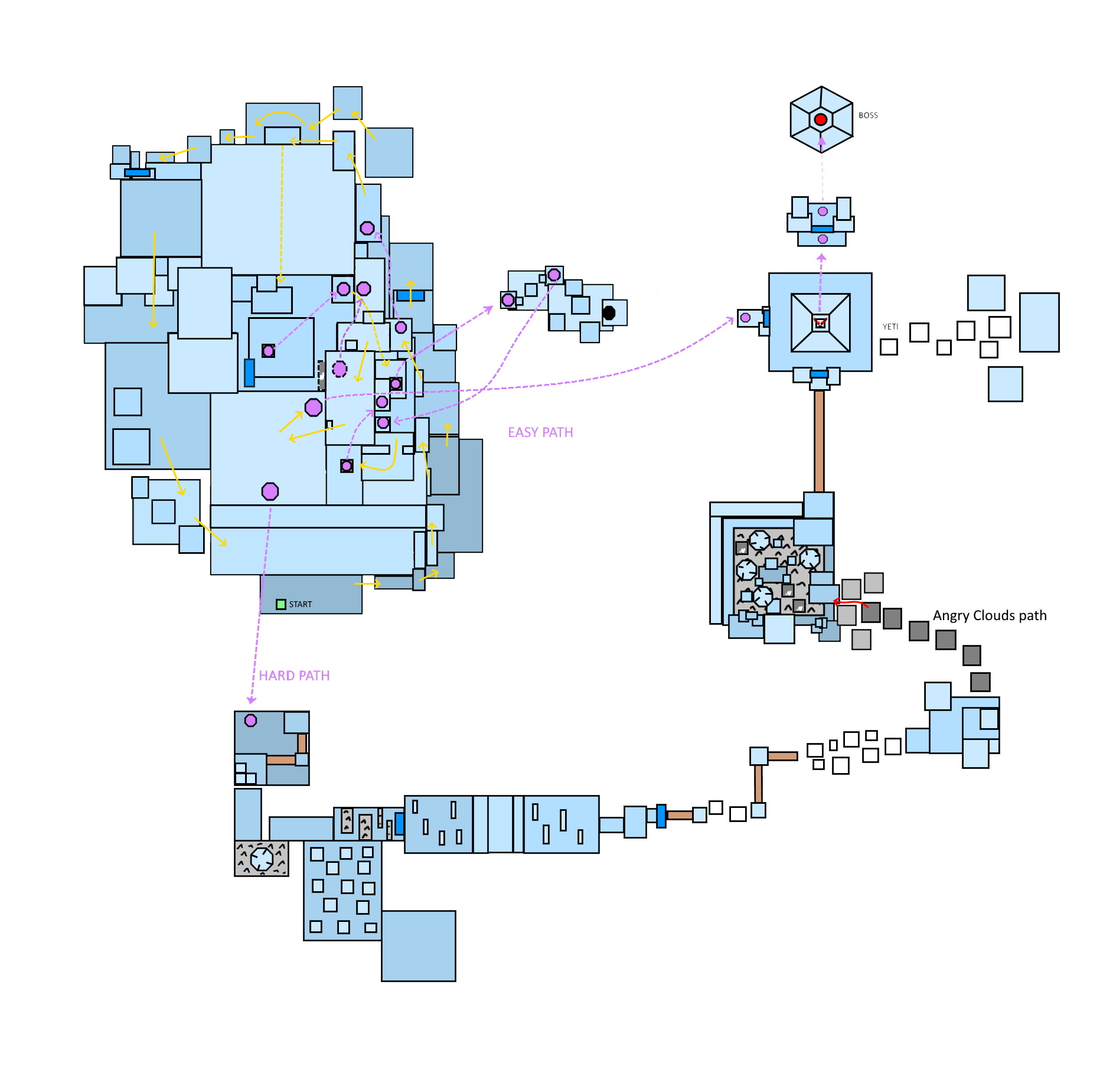 | 1,885 × 1,849 (345 KB) | Inquest Overseer Ezrielia (talk | contribs) | after looking again at some video guides, I fixed portals. There is ton of them. | |
| 11:57, 3 April 2020 | 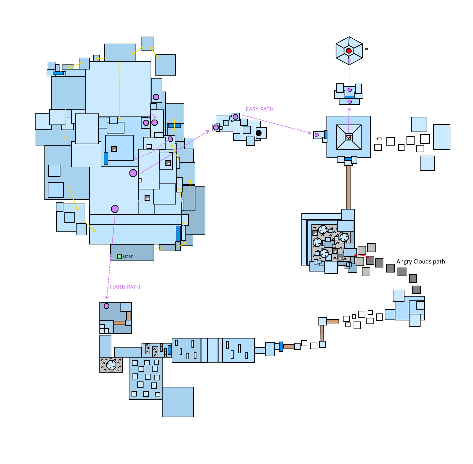 | 1,885 × 1,849 (320 KB) | Inquest Overseer Ezrielia (talk | contribs) | The most difficult map to do, Storm top. I tried to do my best many areas are very hard to cartography because in icy caves. Only the visible parts are shown here, so you don't see within the stone heads, have to base yourself on screenshots. Through added teleporters, checkpoints, and arrows showing the followed path. The blue taints vary on the drawing to explain the altitude. A darker blue is the ground level, light blue the higher level. |
You cannot overwrite this file.
File usage
The following page uses this file: