Category:Wayfarer Foothills area maps
From Guild Wars 2 Wiki
Jump to navigationJump to search
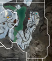
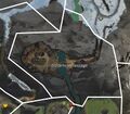
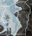
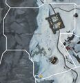
Media in category "Wayfarer Foothills area maps"
The following 27 files are in this category, out of 27 total.
- Borealis Forest map.jpg 1,115 × 828; 358 KB
- Breakneck Pass map.jpg 710 × 578; 161 KB
- Cragstead map.jpg 657 × 973; 305 KB
- Darkriven Bluffs map.jpg 956 × 1,106; 394 KB
- Dawnrise Pass map.jpg 822 × 1,222; 330 KB
- Doldenvan Passage map.jpg 829 × 728; 282 KB
- Dolyak Pass map.jpg 1,237 × 778; 368 KB
- Frusenfell Creek map.jpg 857 × 975; 300 KB
- Grawlenfjord map.jpg 495 × 958; 169 KB
- Halvaunt Snowfield map.jpg 1,174 × 1,217; 773 KB
- Hangrammr Climb map.jpg 940 × 776; 350 KB
- Hunter's Lake map.jpg 1,134 × 821; 343 KB
- Icevine Dale map.jpg 1,055 × 700; 309 KB
- Kresdor Kenning map.jpg 473 × 779; 263 KB
- Moleberia map.jpg 787 × 905; 227 KB
- Molensk map.jpg 1,012 × 1,490; 1.03 MB
- Outcast's Cleft map.jpg 1,500 × 819; 421 KB
- Shaman's Rookery map.jpg 519 × 576; 224 KB
- Snowlord's Gate map.jpg 1,256 × 843; 384 KB
- Solitude Vale map.jpg 897 × 1,163; 397 KB
- Svanir's Dome map.jpg 858 × 1,079; 401 KB
- Taigan Groves map.jpg 895 × 796; 291 KB
- The Grekvelnn Burrows map.jpg 657 × 976; 213 KB
- The Icesteppes map.jpg 1,166 × 980; 415 KB
- The Osenfold Shear map.jpg 954 × 1,056; 396 KB
- The Shadowhorns map.jpg 698 × 675; 171 KB
- Wurmhowl Spikes map.jpg 422 × 600; 109 KB


