Category:Snowden Drifts area maps
From Guild Wars 2 Wiki
Jump to navigationJump to search
Media in category "Snowden Drifts area maps"
The following 26 files are in this category, out of 26 total.
- Darkhoof Heights map.jpg 810 × 559; 161 KB
- Dragon's Rising map.jpg 1,117 × 1,196; 538 KB
- Glisterice Caves map.jpg 908 × 788; 263 KB
- Griffonfall map.jpg 884 × 749; 247 KB
- Hrothgar's Pass map.jpg 1,397 × 791; 446 KB
- Hunter's Pitfalls map.jpg 575 × 980; 212 KB
- Isenfall Gullies map.jpg 1,142 × 744; 343 KB
- Isenfall Lake map.jpg 965 × 1,566; 542 KB
- Jormabakke Stead map.jpg 598 × 547; 143 KB
- Jotun's Vista map.jpg 906 × 693; 265 KB
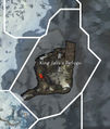
- King Jalis's Refuge map.jpg 595 × 703; 166 KB
- Lornar's Gate map.jpg 1,032 × 964; 358 KB
- Molengrad map.jpg 791 × 628; 365 KB
- Oros Spurs map.jpg 940 × 985; 335 KB
- Ossencrest Climb map.jpg 850 × 892; 277 KB
- Owl's Abattoir map.jpg 1,079 × 1,354; 390 KB
- Reaver's Dale map.jpg 990 × 778; 326 KB
- Skradden Slopes map.jpg 994 × 1,184; 438 KB
- Song of Final Exile map.jpg 816 × 673; 201 KB
- The Frozen Sweeps map.jpg 1,044 × 926; 373 KB
- The Loneholme Range map.jpg 872 × 837; 299 KB
- Trapper's Labyrinth map.jpg 753 × 640; 179 KB
- Tromigar Valley map.jpg 1,386 × 977; 581 KB
- Valslake map.jpg 1,751 × 1,313; 794 KB
- Villmark Foothills map.jpg 862 × 485; 172 KB
- Vitpeln Hills map.jpg 1,056 × 816; 364 KB

