Category:Kessex Hills area maps
From Guild Wars 2 Wiki
Jump to navigationJump to search
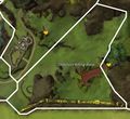
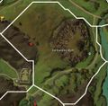
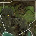
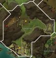
Media in category "Kessex Hills area maps"
The following 25 files are in this category, out of 25 total.
- Alakess Ledge map.jpg 1,221 × 519; 194 KB
- Blackroot Cut map.jpg 809 × 659; 196 KB
- Cereboth Canyon map.jpg 849 × 1,585; 420 KB
- Darkwound Defile map.jpg 460 × 754; 117 KB
- Delanian Foothills map.jpg 803 × 629; 191 KB
- Dominion Killing Zone map.jpg 915 × 837; 258 KB
- Draithor's Demesnes map.jpg 383 × 555; 99 KB
- Earthlord's Gap map.jpg 1,141 × 861; 282 KB
- Earthworks Bluff map.jpg 1,023 × 1,003; 337 KB
- Eukaryan Caves map.jpg 539 × 667; 290 KB
- Fort Salma map.jpg 781 × 501; 100 KB
- Giant's Passage map.jpg 797 × 1,049; 287 KB
- Greyhoof Meadows map.jpg 933 × 935; 295 KB
- Halacon Cataracts map.jpg 1,207 × 791; 263 KB
- Lychcroft Mere map.jpg 1,671 × 699; 398 KB
- Manefire Hills map.jpg 721 × 915; 212 KB
- Meremoot Hill map.jpg 977 × 527; 174 KB
- Overlord's Greatcamp map.jpg 1,013 × 627; 226 KB
- Sojourner's Way map.jpg 1,177 × 679; 265 KB
- Thunder Ridge map.jpg 1,117 × 539; 213 KB
- Triskellion Vale map.jpg 1,013 × 1,053; 338 KB
- Viath Shore map.jpg 591 × 1,195; 225 KB
- Viathan Lake map.jpg 955 × 1,717; 475 KB
- Viathan's Arm map.jpg 1,158 × 1,046; 367 KB
- Wizard's Fief map.jpg 944 × 1,232; 307 KB


