Category:Fields of Ruin area maps
From Guild Wars 2 Wiki
Jump to navigationJump to search
Media in category "Fields of Ruin area maps"
The following 26 files are in this category, out of 26 total.
- Axedrag Cut map.jpg 774 × 839; 319 KB
- Belag Crossroads map.jpg 700 × 822; 253 KB
- Bento Canyon map.jpg 666 × 940; 199 KB
- Blackwing Excavation map.jpg 567 × 679; 184 KB
- Dragonrot Domains map.jpg 861 × 702; 262 KB
- Flameroot Caverns map.jpg 767 × 634; 227 KB
- Gillfarn Plains map.jpg 1,260 × 663; 349 KB
- Grimm Hills map.jpg 879 × 1,119; 420 KB
- Halkor Meadows map.jpg 812 × 978; 336 KB
- Hautclaire Vale map.jpg 1,119 × 886; 410 KB
- Highden Caves map.jpg 580 × 843; 221 KB
- Hunter's Gorge map.jpg 806 × 888; 349 KB
- Last Stand Shelter map.jpg 505 × 693; 154 KB
- Mithric Cliffs map.jpg 1,070 × 946; 428 KB
- Secluded Glen map.jpg 355 × 347; 56 KB
- Sniper's Woods map.jpg 1,015 × 966; 413 KB
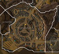
- Stronghold of Ebonhawke map.jpg 1,413 × 1,306; 893 KB
- Tanglerot Hills map.jpg 743 × 1,025; 315 KB
- Tenaebron Lake map.jpg 829 × 1,745; 569 KB
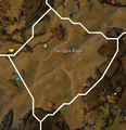
- The Ogre Road map.jpg 790 × 820; 286 KB
- The Siege Plains map.jpg 1,126 × 1,120; 538 KB
- Thunderbreak Hills map.jpg 1,407 × 1,045; 581 KB
- Varim's Run map.jpg 836 × 1,024; 475 KB
- Vulture's Sweep map.jpg 771 × 996; 308 KB
- Warrior's Crown map.jpg 1,269 × 1,224; 662 KB
- Wildlin Narrows map.jpg 1,067 × 1,034; 464 KB
