Category:Diessa Plateau area maps
From Guild Wars 2 Wiki
Jump to navigationJump to search
Media in category "Diessa Plateau area maps"
The following 28 files are in this category, out of 28 total.
- Arcovian Foothills map.jpg 683 × 1,083; 336 KB
- Blackblade Lake map.jpg 1,421 × 1,102; 864 KB
- Bloodcliff Quarry map.jpg 845 × 855; 482 KB
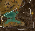
- Breachwater Lake map.jpg 1,031 × 926; 403 KB
- Bulliyak Arsenal map.jpg 848 × 427; 175 KB
- Burrows of Moledavia map.jpg 1,164 × 919; 491 KB
- Flame Temple Tombs map.jpg 772 × 845; 413 KB
- Freewain Pastures map.jpg 1,299 × 1,418; 1.03 MB
- Gram Hills map.jpg 1,037 × 966; 476 KB
- Halrunting Plains map.jpg 891 × 1,091; 667 KB
- Holystone Caves map.jpg 641 × 1,247; 333 KB
- Incendio Templum map.jpg 1,139 × 1,085; 509 KB
- Manbane's Outcrop map.jpg 1,153 × 622; 313 KB
- Nemus Groves map.jpg 1,027 × 1,325; 593 KB
- Noxin Dells map.jpg 994 × 605; 253 KB
- Oldgate Clearing map.jpg 1,028 × 809; 355 KB
- Rancher's Wash map.jpg 878 × 1,329; 473 KB
- Reaper's Corridor map.jpg 768 × 849; 292 KB
- Ruins of Oldgate map.jpg 452 × 695; 131 KB
- Sanctum Way map.jpg 1,451 × 872; 563 KB
- Spider Nest Cavern map.jpg 798 × 736; 242 KB
- The Blasted Moors map.jpg 744 × 947; 317 KB
- The Breached Wall map.jpg 1,278 × 778; 416 KB
- The Wurm's Gullet map.jpg 654 × 585; 177 KB
- Town of Nageling map.jpg 849 × 472; 175 KB
- Town of Nolan map.jpg 906 × 598; 252 KB
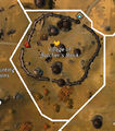
- Village of Butcher's Block map.jpg 562 × 635; 182 KB
- Wodron Glens map.jpg 1,066 × 867; 377 KB


