Category:Caledon Forest area maps
From Guild Wars 2 Wiki
Jump to navigationJump to search
Media in category "Caledon Forest area maps"
The following 21 files are in this category, out of 21 total.
- Dominion of Winds (area) map.jpg 552 × 2,114; 367 KB
- Dreamdark Enclave map.jpg 511 × 330; 78 KB
- Glencarn Sperrins map.jpg 1,261 × 966; 604 KB
- Grenbrack Delves map.jpg 644 × 928; 335 KB
- Mabon Market map.jpg 591 × 368; 127 KB
- Morgan's Spiral map.jpg 738 × 1,345; 499 KB
- Ogham Wilds map.jpg 1,076 × 1,330; 789 KB
- Quetzal Bay map.jpg 1,054 × 2,045; 909 KB
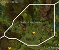
- Ruins of the Unseen map.jpg 669 × 565; 205 KB
- Sandycove Beach map.jpg 1,330 × 953; 669 KB
- Sleive's Inlet map.jpg 774 × 738; 293 KB
- The Rootangles map.jpg 1,129 × 845; 534 KB
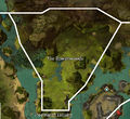
- The Rowanwoods map.jpg 767 × 705; 263 KB
- The Verdence map.jpg 966 × 1,292; 674 KB
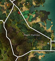
- Titan's Staircase map.jpg 683 × 769; 290 KB
- Trader's Green map.jpg 1,437 × 1,151; 852 KB
- Treemarch Estuary map.jpg 1,211 × 862; 501 KB
- Ventry Bay map.jpg 2,264 × 1,038; 1.04 MB
- Village of Astorea map.jpg 759 × 661; 283 KB
- Willowalk Groves map.jpg 1,063 × 843; 451 KB
- Wychmire Swamp map.jpg 1,184 × 1,842; 1.05 MB


