Category:Auric Basin area maps
From Guild Wars 2 Wiki
Jump to navigationJump to search
Media in category "Auric Basin area maps"
The following 17 files are in this category, out of 17 total.
- Arrowhead Vale map.jpg 1,024 × 708; 320 KB
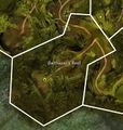
- Balthazar's Rest map.jpg 733 × 774; 225 KB
- Bristleback Chasm map.jpg 833 × 1,515; 549 KB
- Burnisher Quarry map.jpg 1,072 × 1,098; 938 KB
- Chak Hollow map.jpg 1,106 × 793; 342 KB
- Eastwatch Bluff map.jpg 537 × 1,490; 325 KB
- Griffonfall (Auric Basin) map.jpg 845 × 711; 590 KB
- Lastgear Standing map.jpg 830 × 1,092; 389 KB
- Maguuma Shallows map.jpg 725 × 1,085; 355 KB
- Morwood Wilds map.jpg 828 × 667; 208 KB
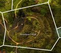
- Mossheart Walk map.jpg 720 × 627; 195 KB
- Northwatch Descent map.jpg 845 × 839; 303 KB
- Southwatch Creep map.jpg 849 × 771; 283 KB
- Tarir, the Forgotten City map.jpg 1,328 × 1,523; 902 KB
- Tarnished Treetop map.jpg 1,148 × 914; 410 KB
- The Falls map.jpg 604 × 640; 457 KB
- Westwatch Patch map.jpg 829 × 1,052; 377 KB

