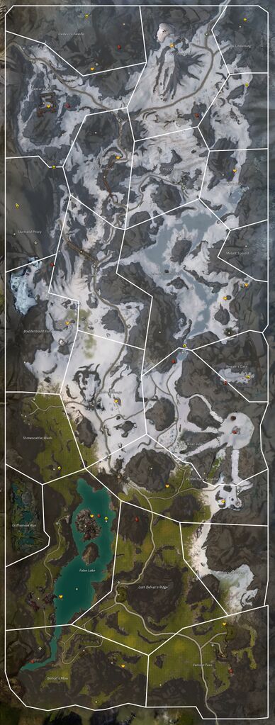
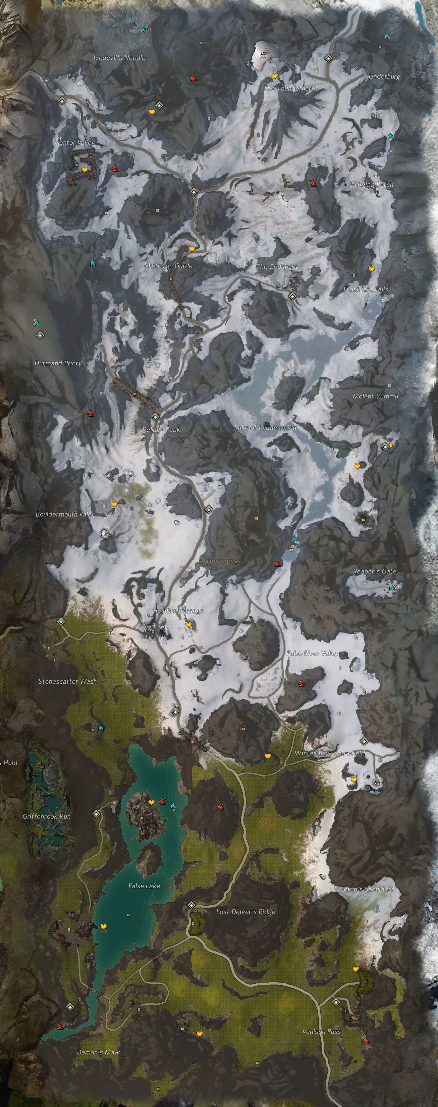
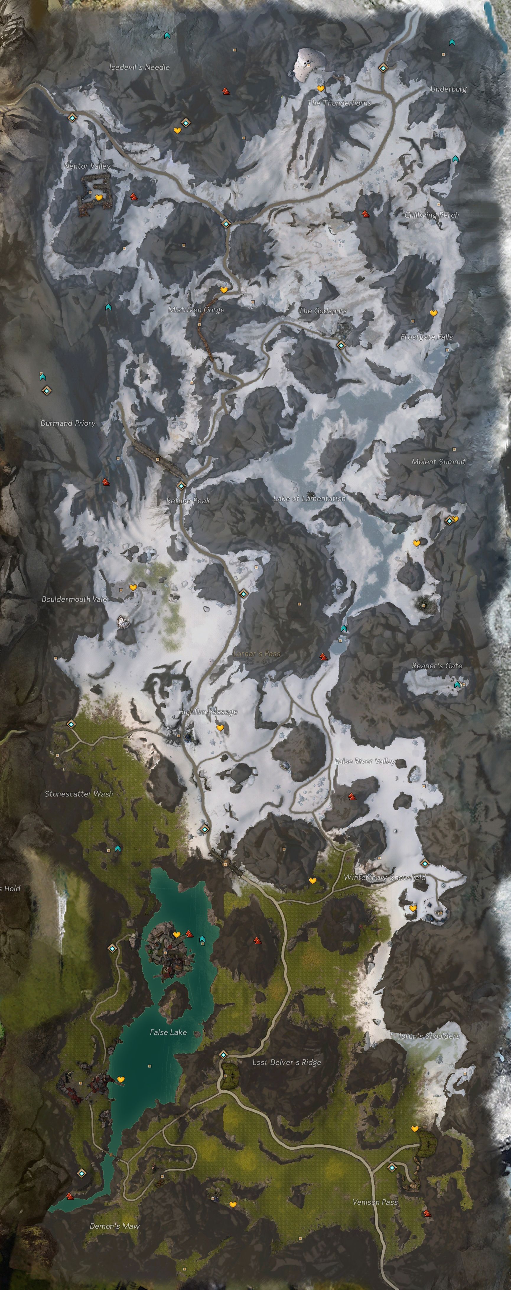
File:Lornar's Pass map.jpg
From Guild Wars 2 Wiki
Jump to navigationJump to search

Size of this preview: 227 × 598 pixels. Other resolutions: 91 × 240 pixels | 182 × 480 pixels | 291 × 768 pixels | 388 × 1,024 pixels | 2,200 × 5,800 pixels.
Original file (2,200 × 5,800 pixels, file size: 6.6 MB, MIME type: image/jpeg)
Licensing[edit]
| This screenshot contains property of ArenaNet or NCSoft which is used with permission. The terms of the permission do not include third party use. It is not released under the GFDL. Please see Guild Wars 2 Wiki:Copyrights for further information. |
File history
Click on a date/time to view the file as it appeared at that time.
| Date/Time | Thumbnail | Dimensions | User | Comment | |
|---|---|---|---|---|---|
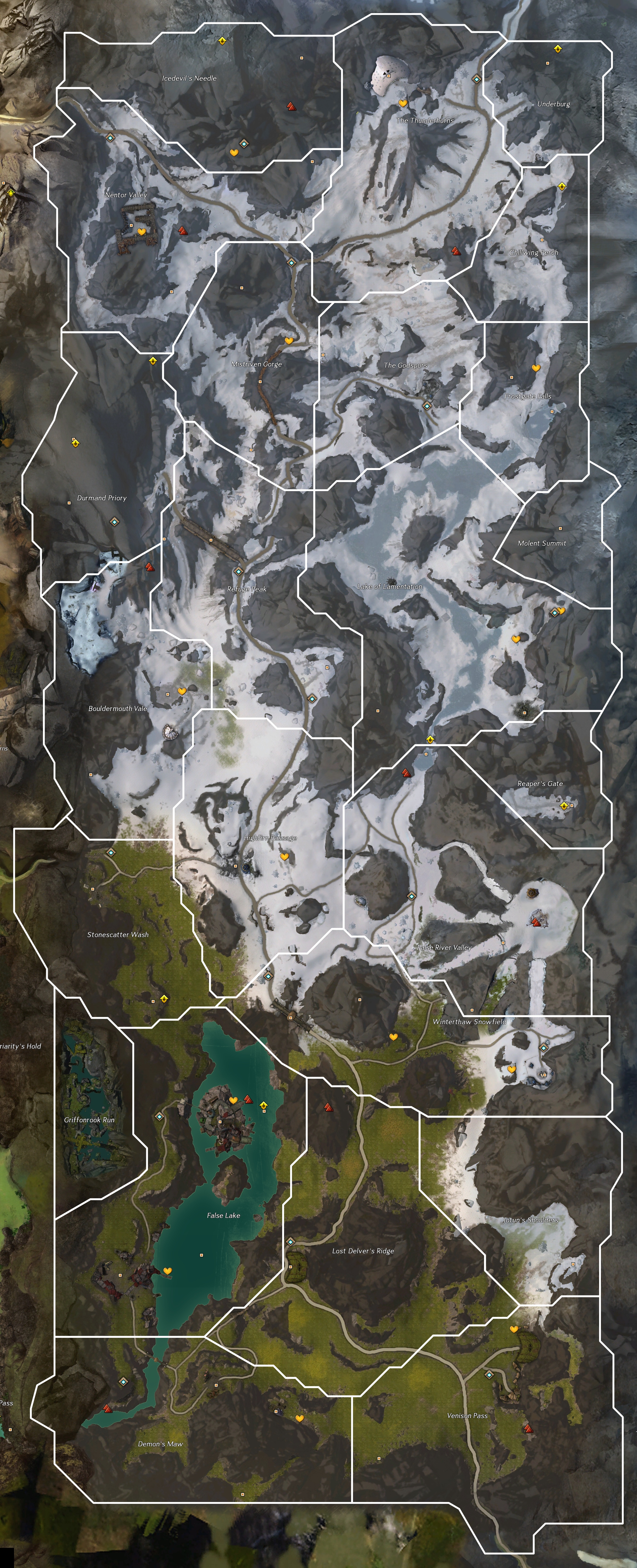
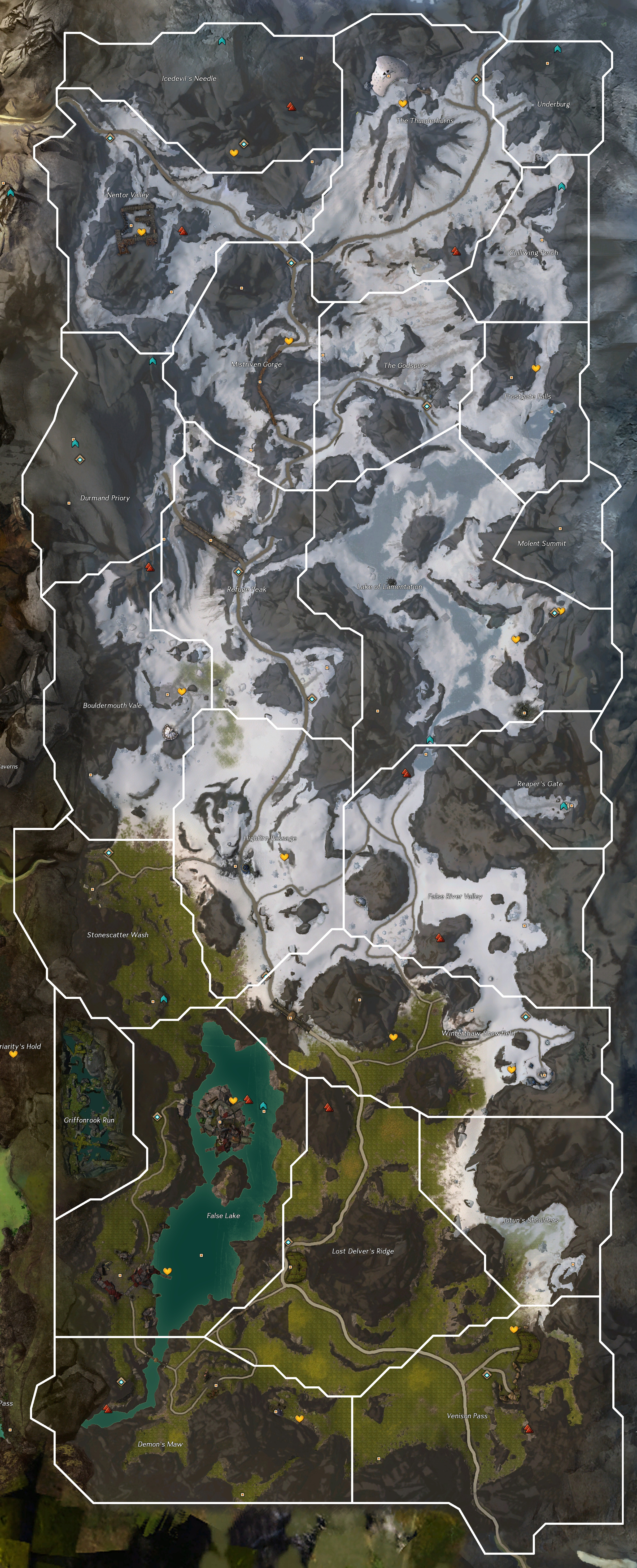
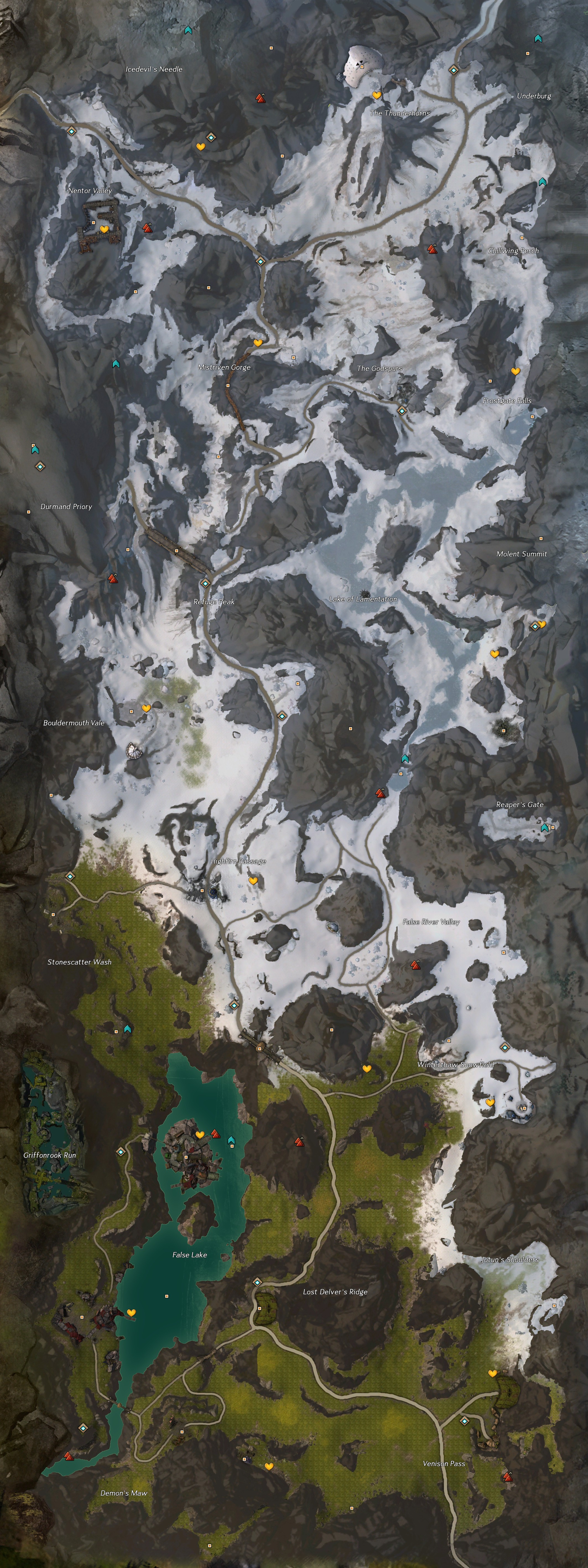
| current | 12:14, 17 July 2022 | 2,200 × 5,800 (6.6 MB) | Chieftain Alex (talk | contribs) | missed a cutout around a wp on snowfield | |
| 12:11, 17 July 2022 | 2,200 × 5,800 (6.6 MB) | Chieftain Alex (talk | contribs) | clean borders from api | ||
| 12:18, 3 April 2016 | 2,402 × 5,913 (4.94 MB) | Chieftain Alex (talk | contribs) | |||
| 12:01, 3 April 2016 | 2,402 × 5,913 (4.94 MB) | Chieftain Alex (talk | contribs) | refined edge around a cave in a hill | ||
| 11:50, 3 April 2016 | 2,402 × 5,913 (4.94 MB) | Chieftain Alex (talk | contribs) | I have a new appreciation for dr ishmael's drawings. | ||
| 15:38, 24 March 2013 | 2,402 × 5,913 (4.75 MB) | Dr ishmael (talk | contribs) | correct placement of a waypoint | ||
| 04:28, 20 March 2013 | 2,402 × 5,913 (4.75 MB) | Dr ishmael (talk | contribs) | updated with area boundaries | ||
| 04:05, 19 October 2012 | 2,126 × 5,671 (2.16 MB) | Dr ishmael (talk | contribs) | max zoom | ||
| 23:15, 21 September 2012 | 1,730 × 4,368 (1.01 MB) | Zerebruin (talk | contribs) | includes Griffonrook Run | ||
| 13:06, 19 September 2012 | 1,730 × 4,368 (1 MB) | Zerebruin (talk | contribs) | English map of Lornar's Pass region |
You cannot overwrite this file.
File usage
The following 2 pages use this file: